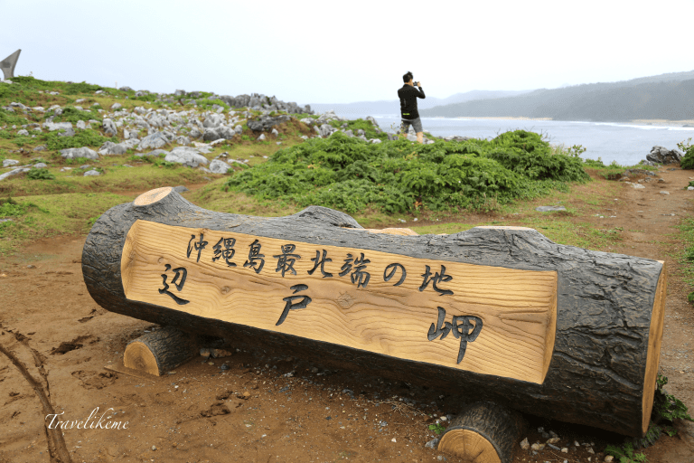
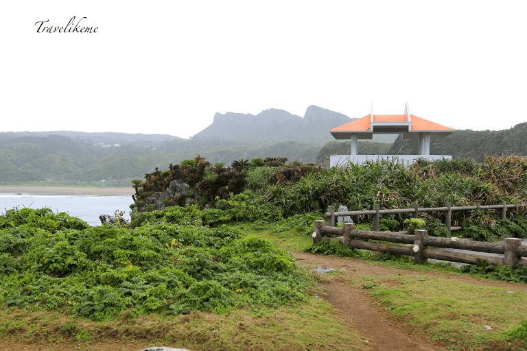
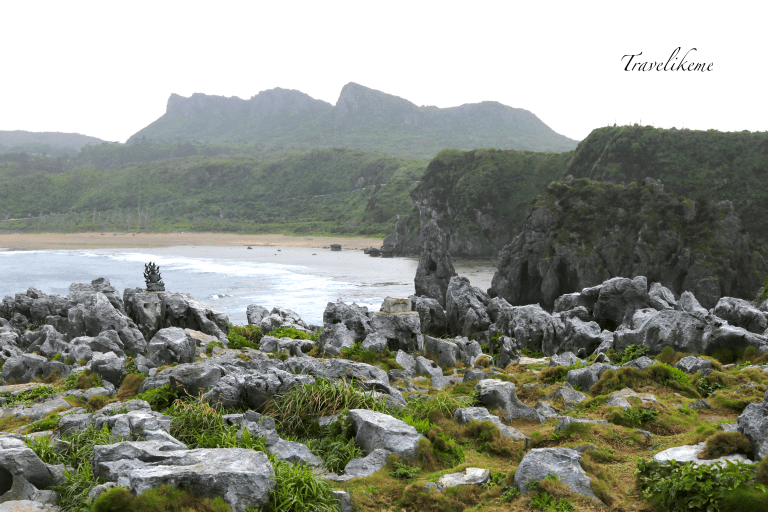
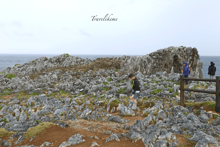
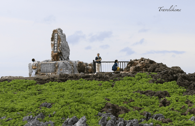
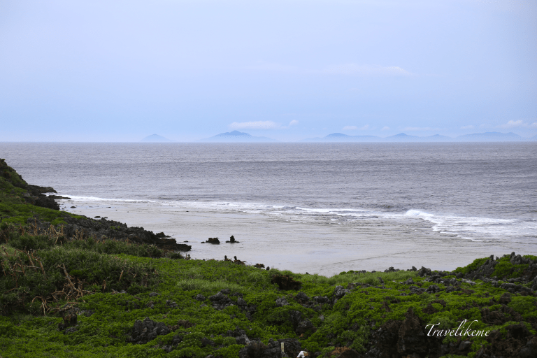
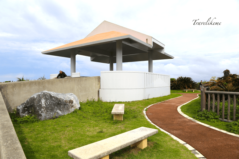
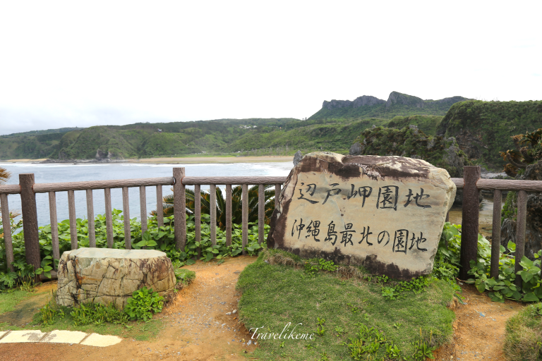
Not far off from JAL Resort Hotel at Okuma & driving about half an hour along the western coastline of Okinawa, you will eventually reach Cape Hedo (Hedo Misaki) lies about 23km away.The turn-off from the main road is not very conspicuous, so do pay attention. Luckily for me I spotted another car turning left behind me & quickly made a U-turn in the right direction.Cape Hedo (Hedo misaki) also known as Hedo Point is situated at the northern-most tip of Okinawa Island (Okinawa Honto). It is part of Okinawa Kaigan Quasi National Park established in 1965 & remained so after Okinawa returned to Japan in 1972.This rocky outcrop faces the South China Sea on the west & the Pacific Ocean on the east.Did not quite expect to see such a panoramic view of sheer cliffs, a nice stretch of sand at Hedo Beach, deep blue waters & the Dai Sekirinzan mountain range in full spectacle.There was a brief shower & I had a hard time trying to keep my brolly up without it flipping upwards as the strong gusty winds just would not let up. Look at the froth as a surface wave breaks & pounds relentlessly at the limestone cliff.The cape formation features an elevated coral reef, a Karst flat tableland & sheer cliffs. What a bizarre & craggy landscape!Verdant vegetation & wildflowers just spring up in the most amazing places & this is the testament of Nature’s power & tenacity. We face the South China Sea at this lookout point.This statue of Kariyushi a legendary creature from Northern Okinawa (Yanbaru) has the head of a bird & the torso of a fish. This monument symbolises the friendship between Kunigami Village & Yoron Island (Yoronjima) in Kagoshima Prefecture.This Monument was erected in 1972 to commemorate Okinawa’s reversion to Japan.This symbolically marked the end of US Occupation & the return of Okinawa to Japanese sovereignty. Some visitors pay homage at the little shrine erected by the side of the monument.Pretty wildflowers like this one sprout profusely all over the grounds. Can anyone help me with the genus?As the weather cleared, we could see Yoron Island (Yoronjima) in the distance. It belongs to the southern most part of the Amami Islands (Amami-eilanden) some 22km away from Hedo Point & comes under the administration of Kagoshima Prefecture. Yoron Island is surrounded by coral reefs & spans 20.8km with a small population of about 6000 people.Lost & Found (Wasuremono) …posted!There is this pavilion is set in a little garden park near the car park which gives you a relatively good view of the sea, mountains, cliffs & beach below. It is also a good resting spot with benches & toilets nearby making a picnic feasible.A sign that marks this place as the most northerly park at Cape Hedo on Okinawa Island.Cape Hedo (Hedo Misaki) was mentioned in the Japanese Provincial land maps (ShohoKuniezu) during the Edo Period (1603-1868) as ‘Heto Misaki‘. Commodore Perry (1794-1858) visited the cape in an expedition & recorded it as ‘Cape Hope”& Nihon Suiroshi a pilot guide recorded the cape in 1892 as ‘Cape Kunigami’ which was commonly used as a nautical landmark.
Japanese Sago Palm (Cycas Revoluta) native to southern Japan including the Ryukyu Islands, thrive in this subtropical climate. It is hardy & tolerates numerous growing conditions & prefer well-drained soil. It is one of the species used in sago production as well as an ornamental plant. A panoramic view of Hedo Beach & the limestone stacks that still remain. Does it not remind you of the “12 Apostles” along the Great Ocean Road in Victoria.
I highly recommend a visit to Cape Hedo if you are doing a self-drive trip, as traffic is light & the road conditions are good. The drive along the eastern coast line is more scenic if you can spare the time otherwise the more direct route along the Highway would suffice. This site has become a tourist destination because of its unique geographical location & it was thrilling for me just to be there. The priceless view at Hedo Misaki is prize enough!


 Japanese Sago Palm (Cycas Revoluta) native to southern Japan including the Ryukyu Islands, thrive in this subtropical climate. It is hardy & tolerates numerous growing conditions & prefer well-drained soil. It is one of the species used in sago production as well as an ornamental plant.
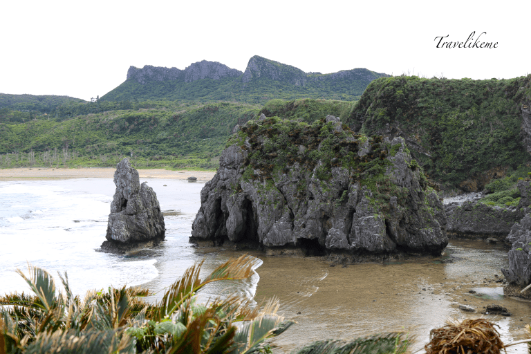 A panoramic view of Hedo Beach & the limestone stacks that still remain. Does it not remind you of the “12 Apostles” along the Great Ocean Road in Victoria.