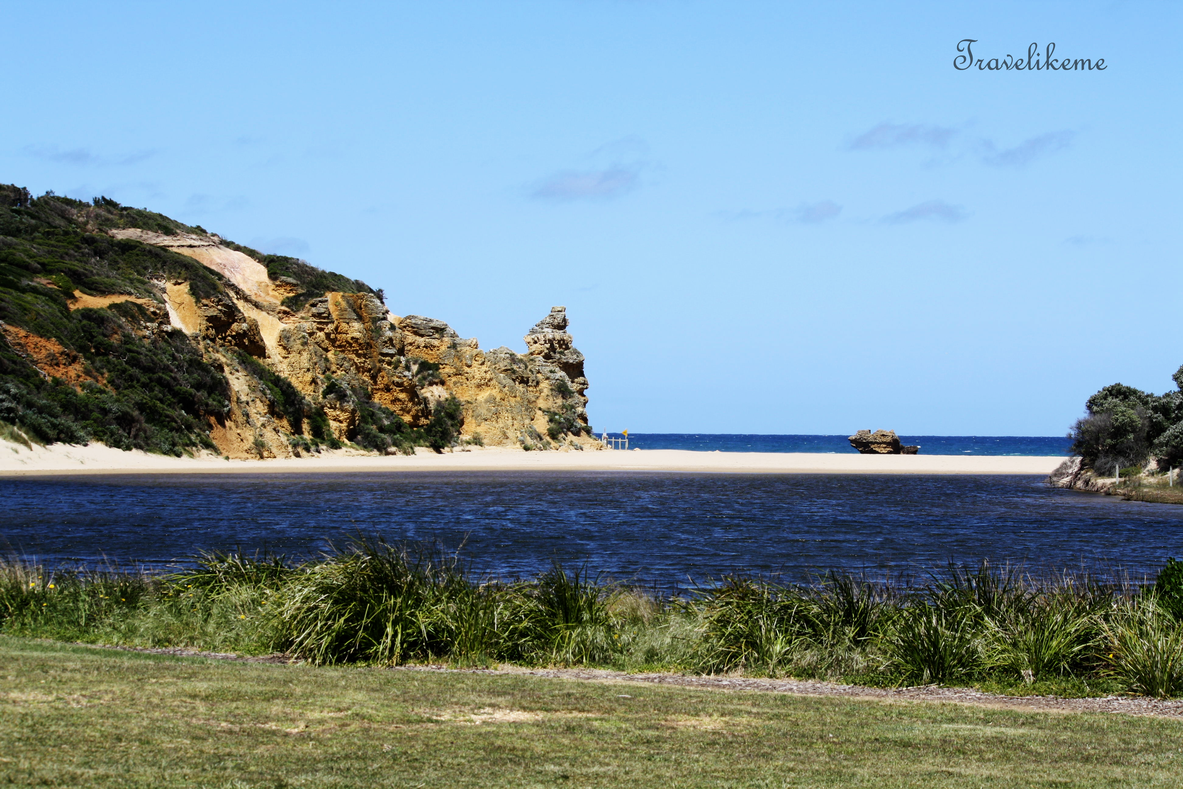
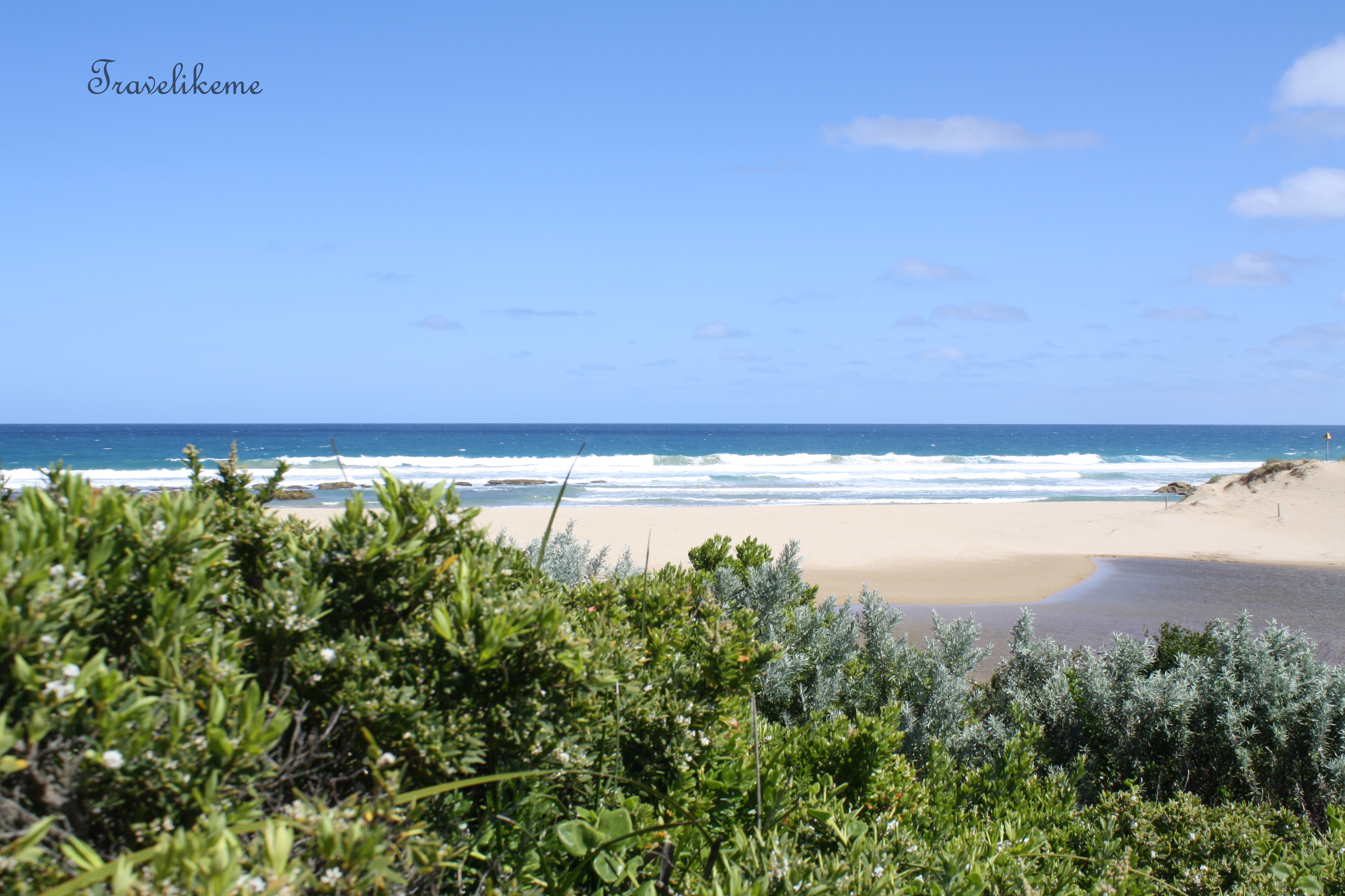
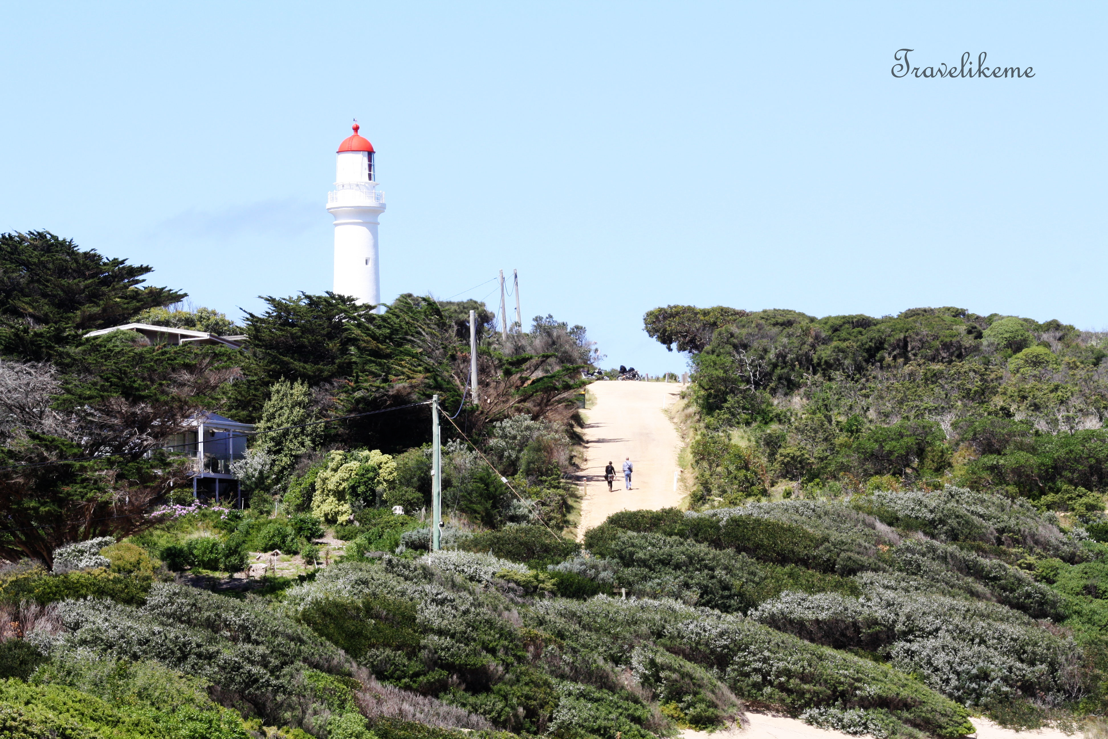
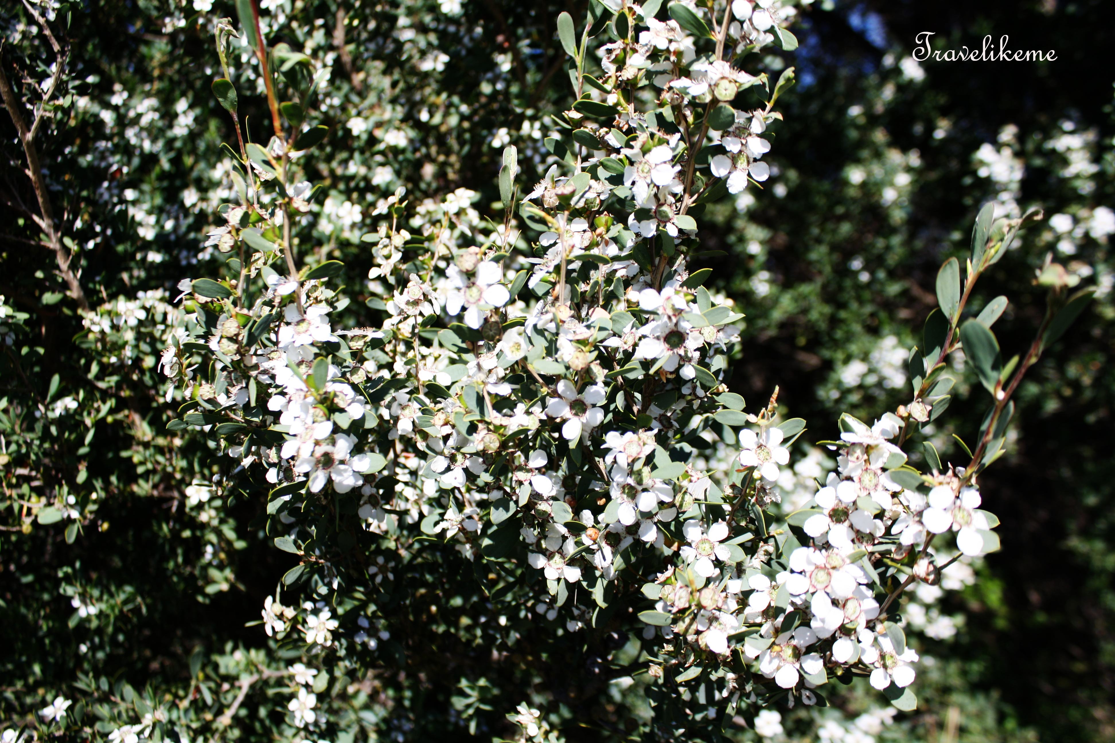
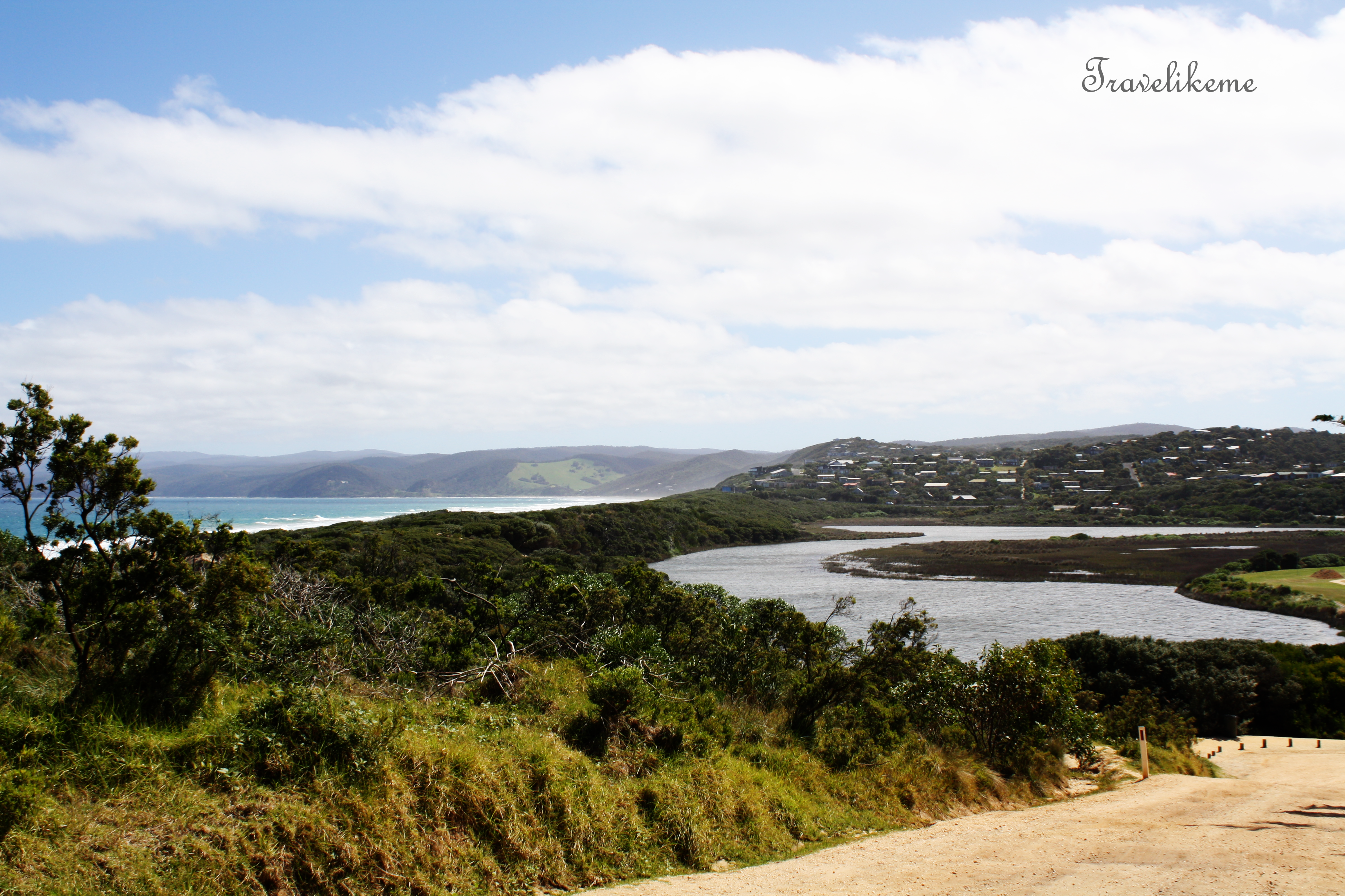
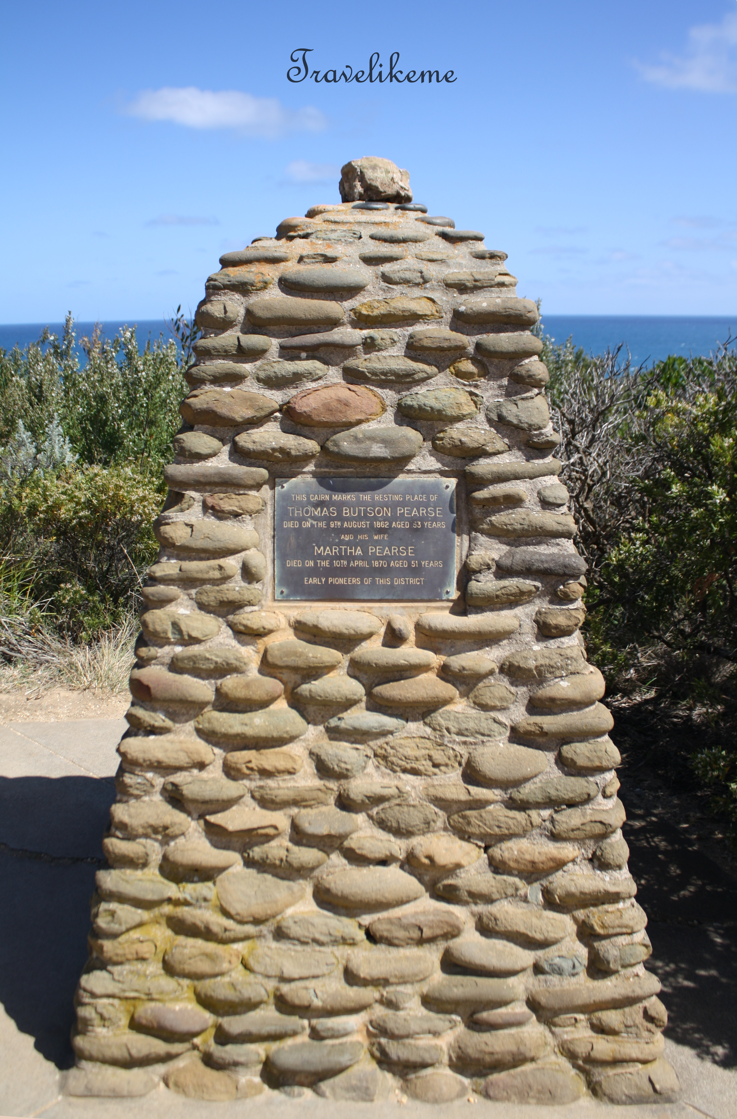
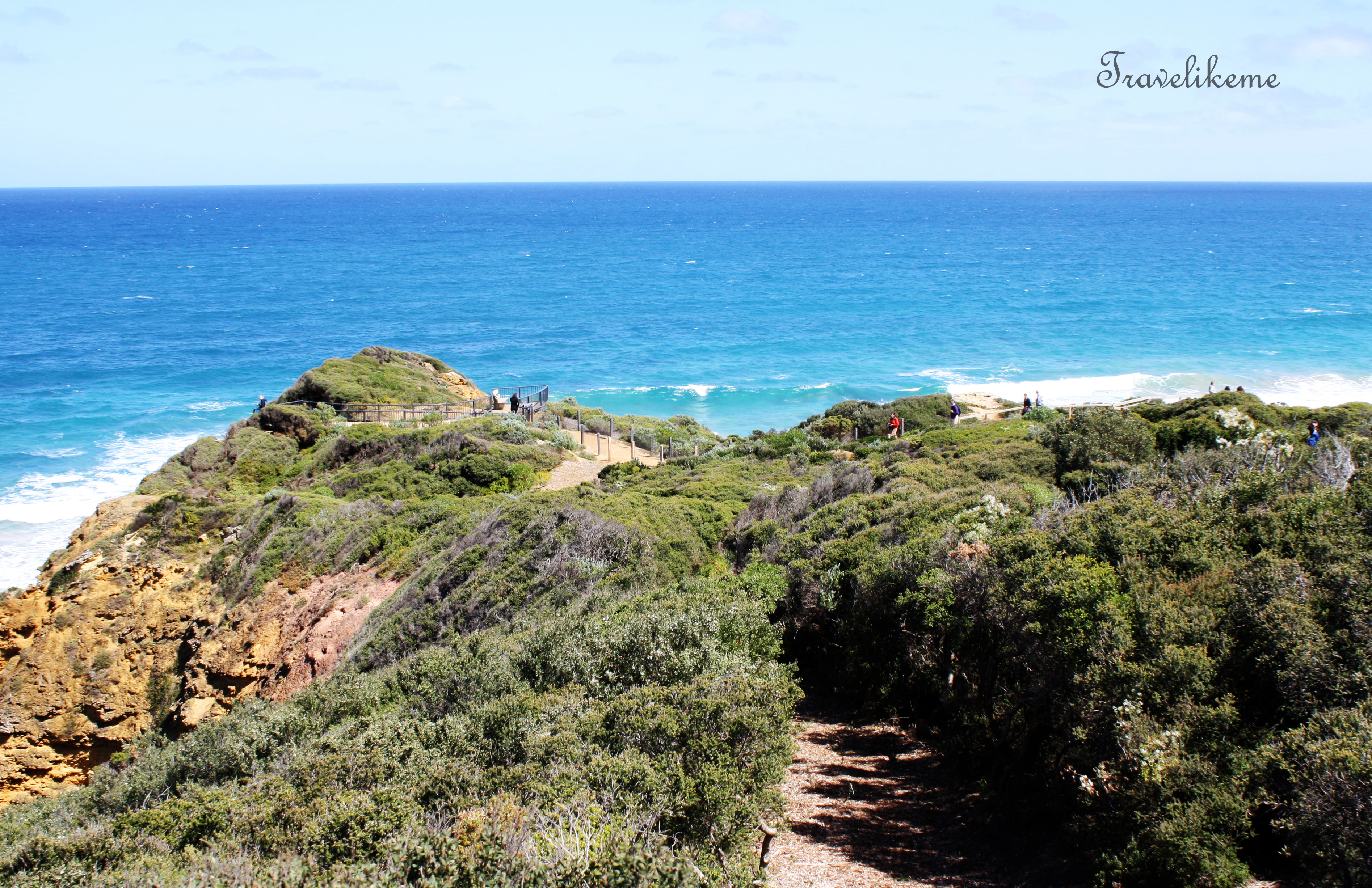
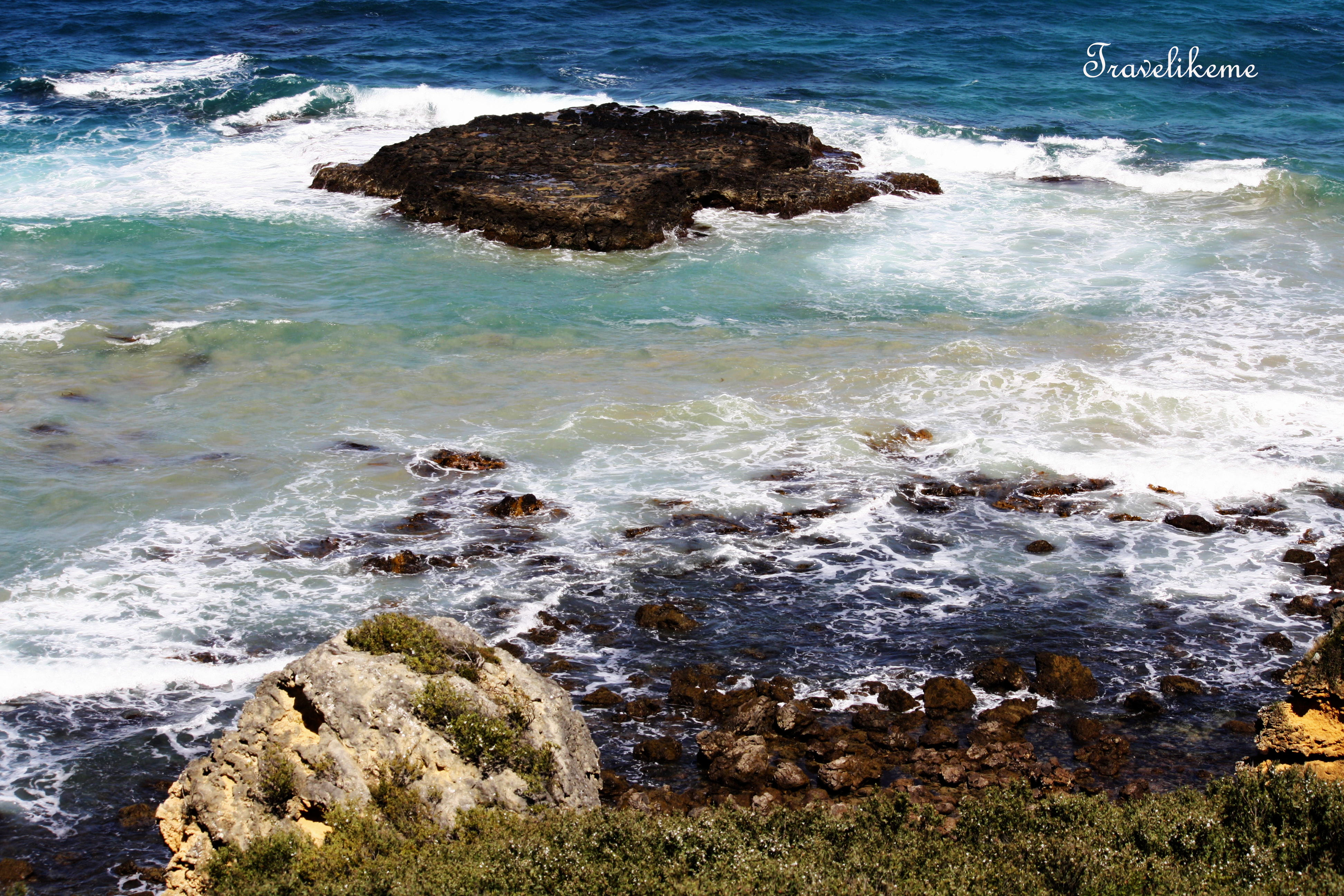
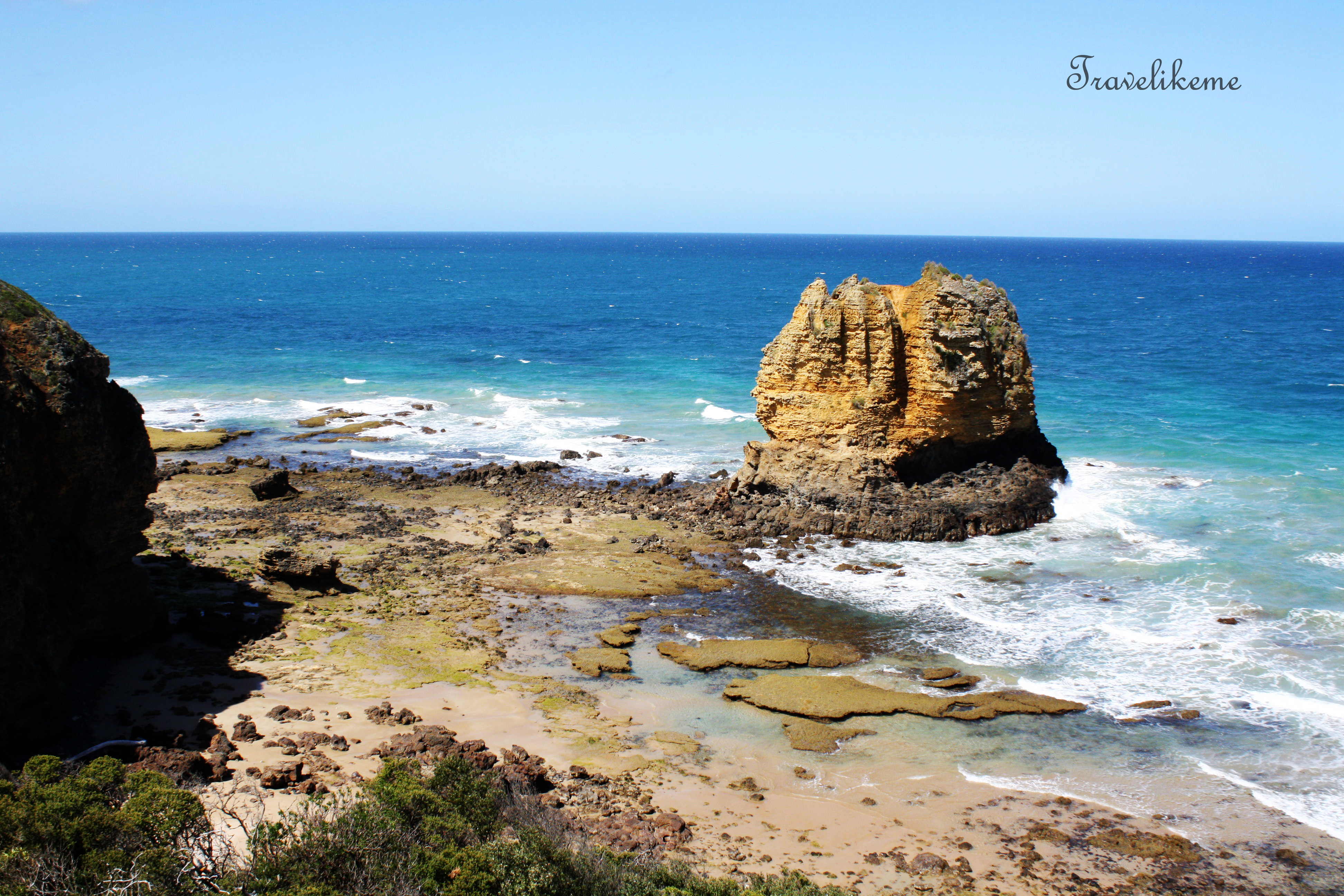
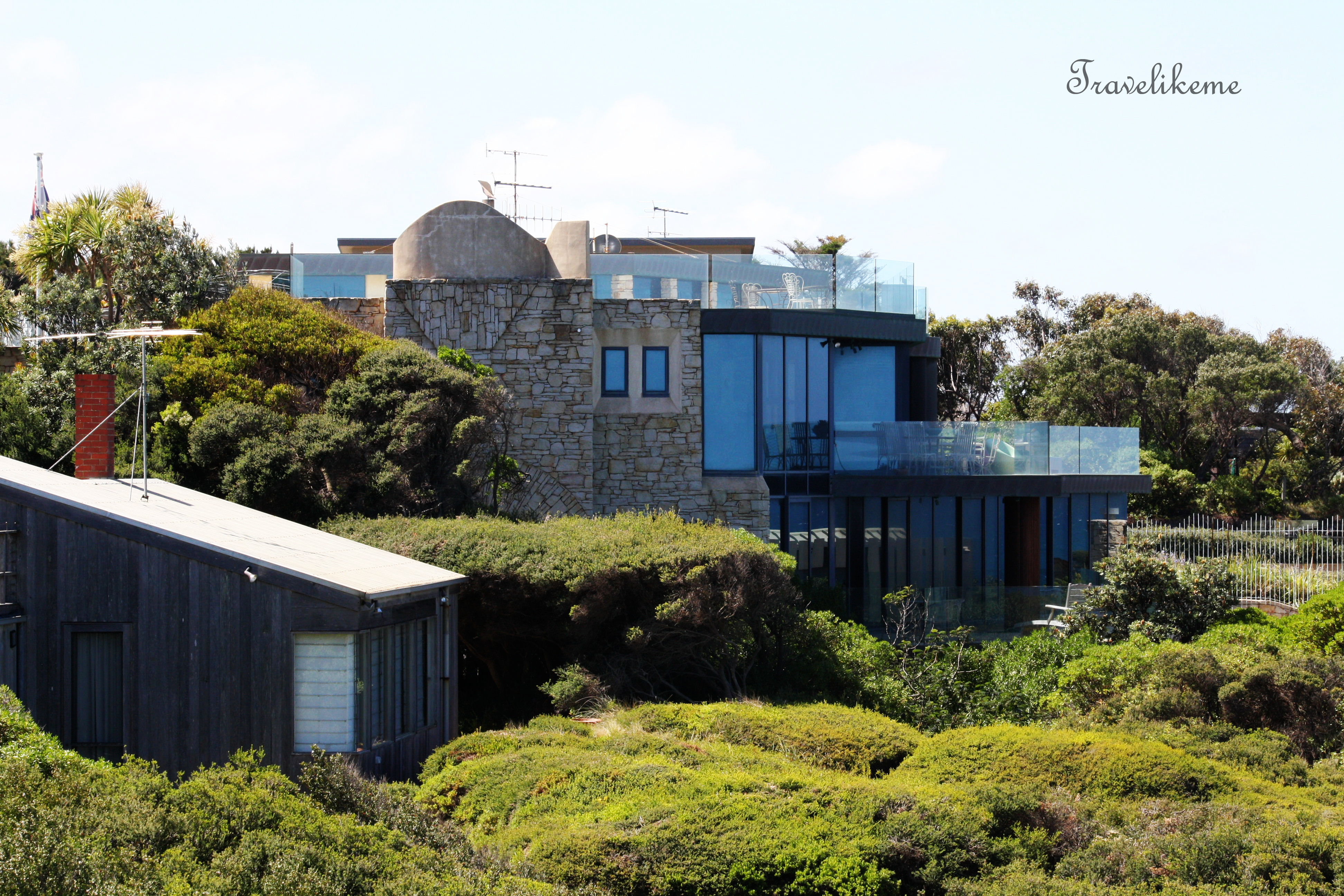
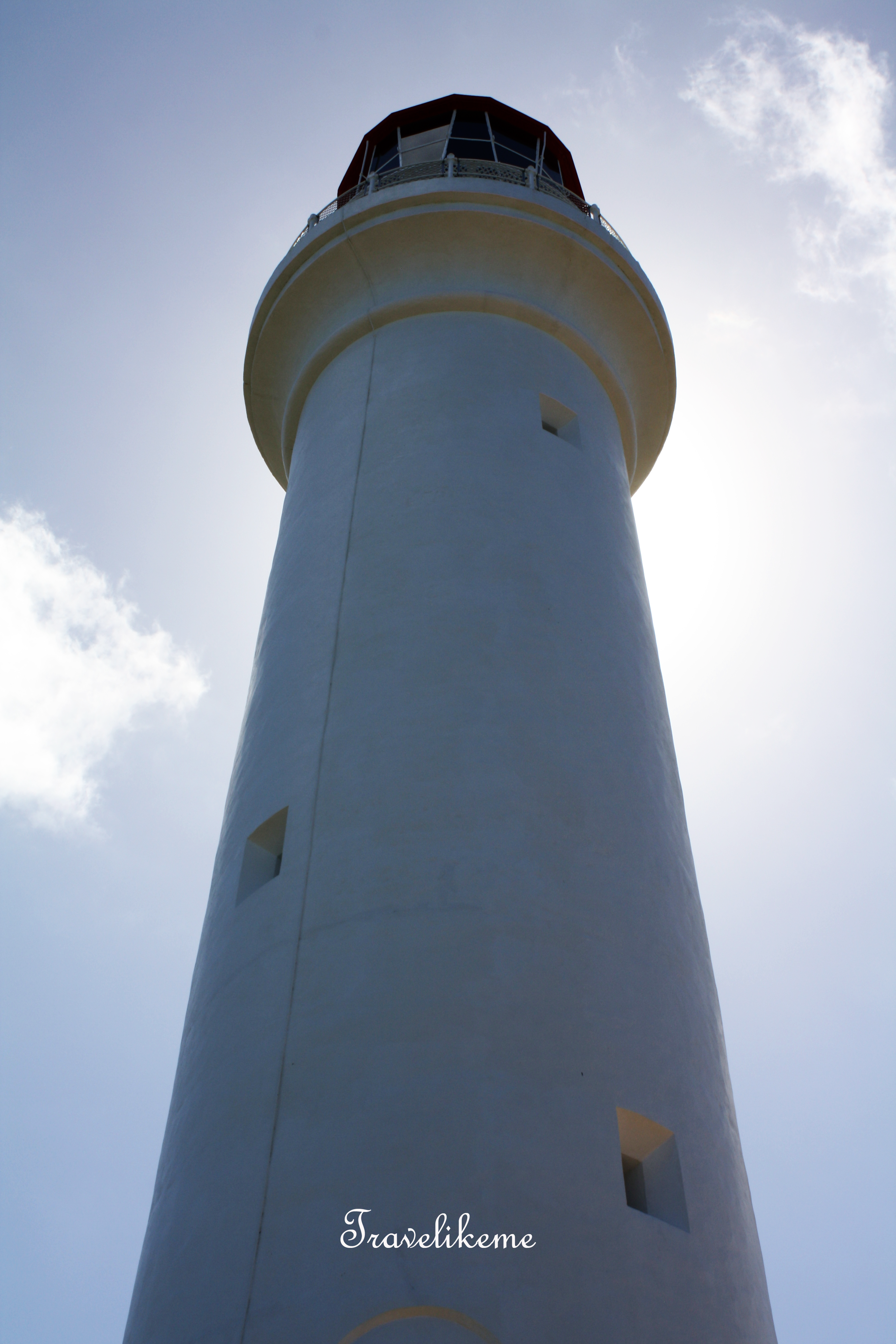
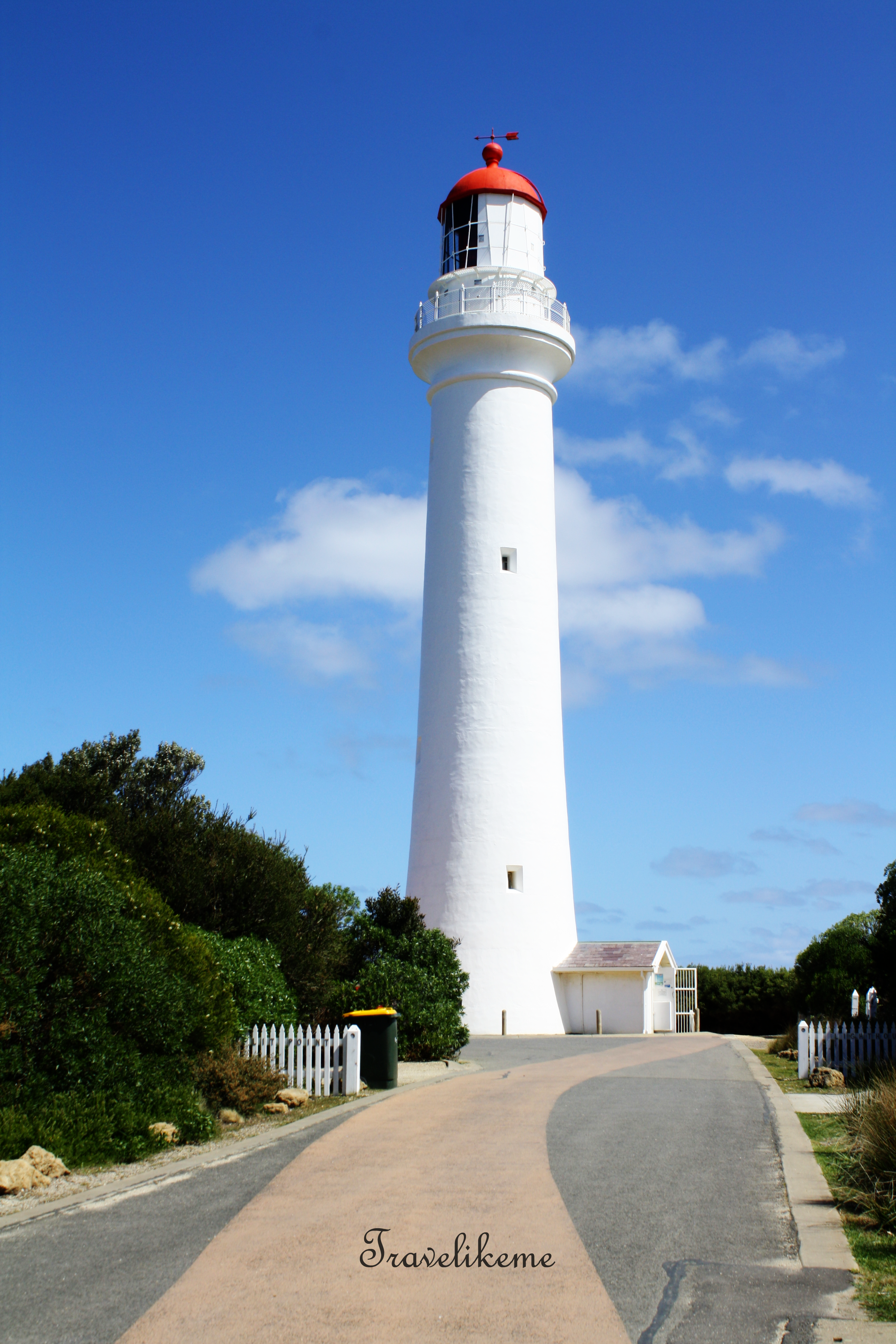
Painkalac Creek, shaped like a horseshoe, is part of the Aireys Inlet Foreshore ReserveMouth Beach separates Painkalac Creek & the Bass Strait. Due to low water levels in the inlet, it is not often that the inlet breaks throughIt is about 1.5km from the carpark & uphill to Spilt Point Lighthouse. The climb was steep & the dirt track a little slippery & it left unfit me huffing & puffingI noticed that the bushes in the whole area was flowering profusely. It is a shrub commonly known as ‘Tea Tree’ or ‘ Manuka’ which comes from the Myrtle family. Leptospermum is part of the Myrtaceae genus.Amazing view at the top of the hill, where Painkalac Creek & the Bass Strait can be seen togetherAerial View from Spilt Point looking over Fairhaven Beach & beyond to Apollo BayMemorial Stone in honour of Thomas Butson Pearse & his wife Martha who were early pioneers in this districtSpilt Point LookoutSpilt Point was originally called Eagles Nest Point & it was probably renamed when the lighthouse was constructed in 1891Surf crashing into the Basalt & Limestone rock shelves. Seen here is the Table Rock which has been levelled by incessant wavesEagle Rock Marine Sanctuary located at Aireys Inlet is a 17ha park that projects 300m offshore & protects the surrounding ocean watersThe remaining Eagle Rock is a tall, volcanic stack capped by limestoneBeautiful villa along Federal Street facing the Bass StraitSpilt Point Lighthouse is located in Aireys Inlet a small town on the Great Ocean Road, Victoria, Australia.’ Masterchef Season 6′ & ‘ Round the Twist’, a popular children’s TV series was filmed in this area.Towering above us at 34m, there are 132 steps to the balcony just below the lantern roomLocated at the end of Federal Street, the white tower with a red lantern roof is fondly called the ‘ The White Queen’ by the locals. She has been operational since 1891 but was automated in 1919 & still sends her beacon of light to passing ships to steer clear of the rocky shores, going to & fro Port Phillip Bay