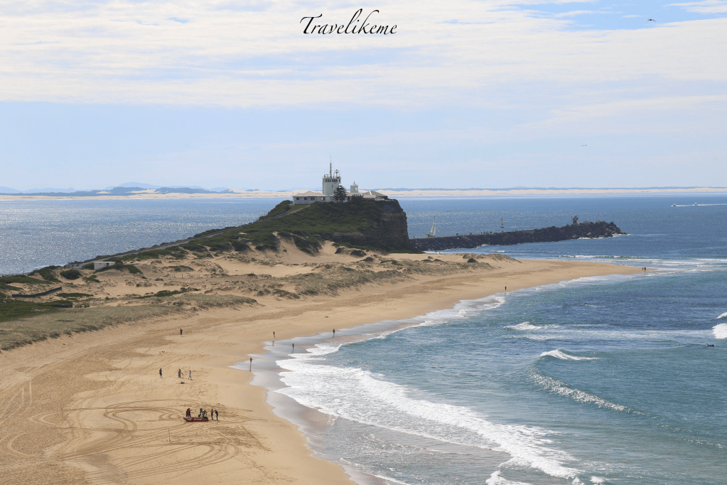
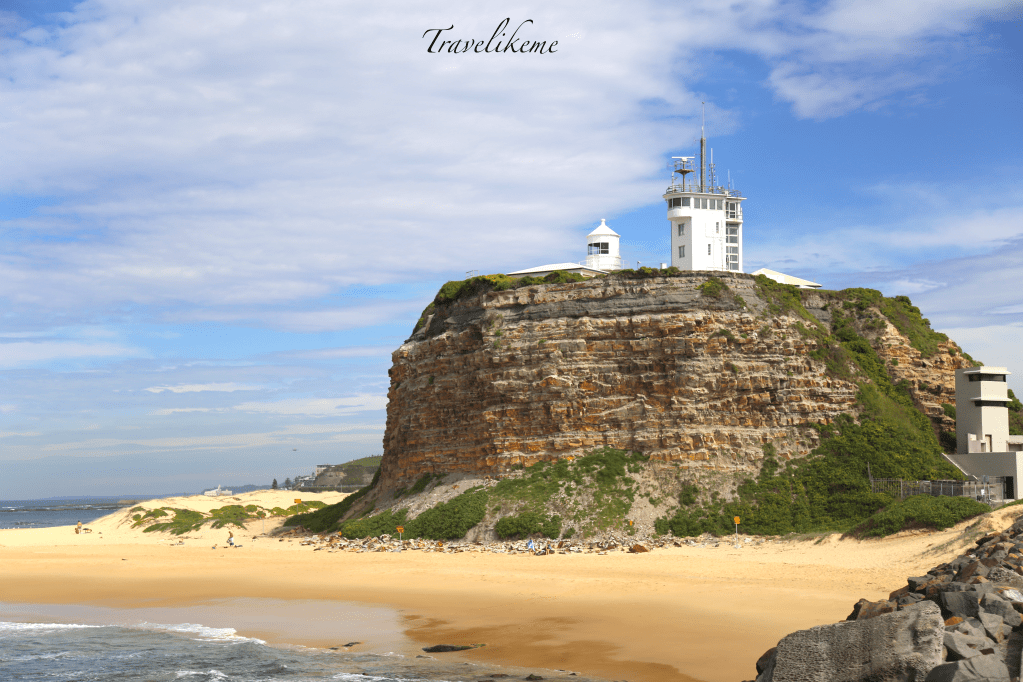
Nobby’s Headlight & Macquarie Pier seen here from Horseshoe Beach.
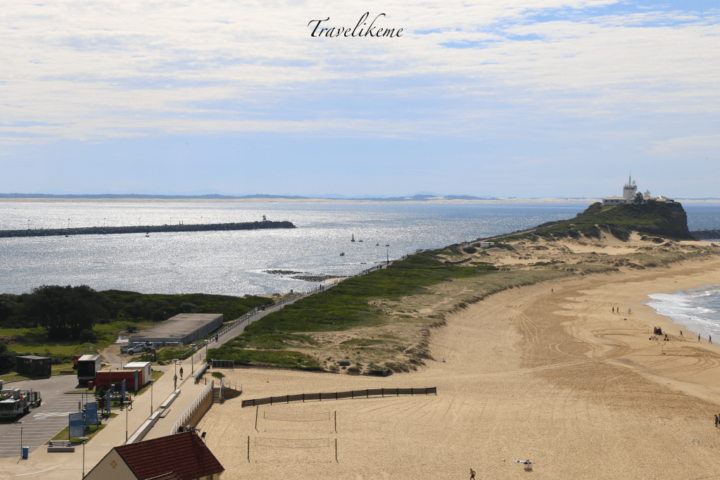
Aerial view of Macquarie Pier from Fort Scratchley in Newcastle, New South Wales of Australia.
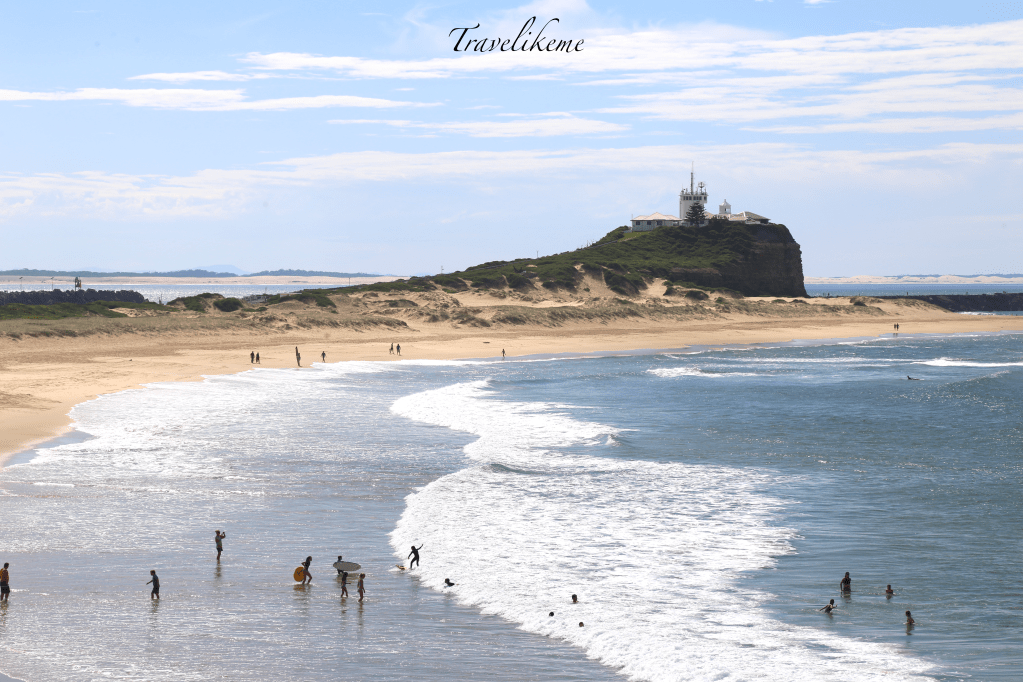
Beach-goers enjoying the sun, sand, sea, surf & a game of beach volleyball at Nobby’s Beach.
Nobby’s lighthouse is featured in the Coat of Arms of Newcastle City & shows how it is valued historically & socially by the local community.
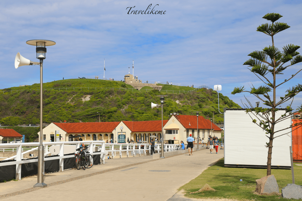
Up on Flagstaff Hill is Fort Scratchley which was built in 1882 & formerly a coastal defence installation against the threat of Russian attacks. Funded by the Australian government restoration works costing about A$10 million began in 2004 & Fort Scratchley together with a museum was re-opened to the public in Jun 2008.
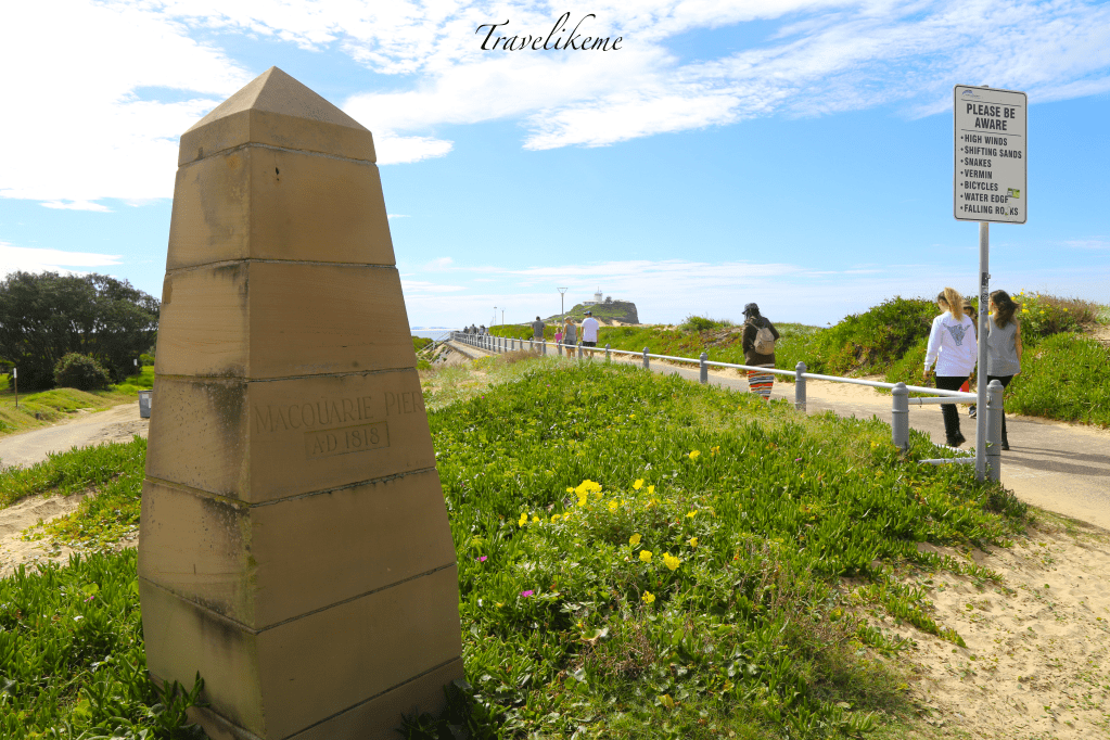
Macquarie Pier celebrated her Bicentennial on 5th Aug 2018. Construction started in 1818 when Governor Lachlan Macquarie laid the foundation stone for this 1.5km link between Coal Island aka Nobby’s to the mainland. Through many turns of events, it was finally completed in 1846.
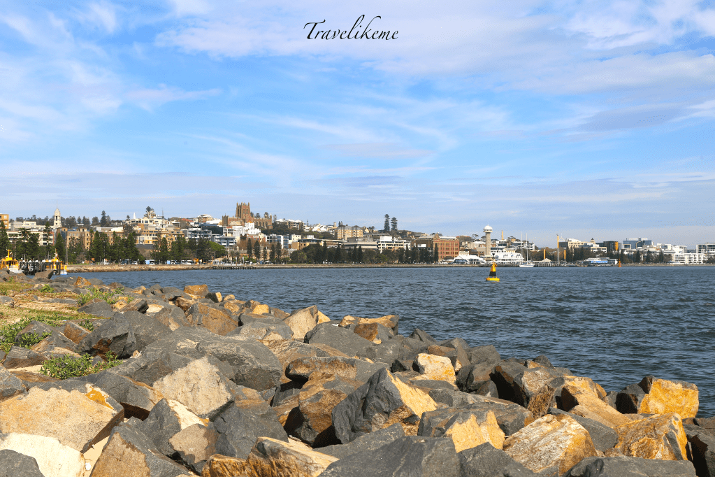
Downtown Newcastle is located at the mouth of the Hunter River & it is also the 2nd most populated area in the Australian state of New South Wales. Newcastle is the world’s largest coal exporting port & Australia’s oldest & 2nd largest tonnage port with over 3,000 shipping movements handling cargo of which 90% is coal.
We see Stockton which is a peninsula opposite Macquarie Pier & Hunter River which leads to the Port of Newcastle. The Port remains an important economic & trade centre for the resource rich Hunter Valley & for much of North & Northwest New South Wales, Australia.
Nobby’s Lighthouse was originally built in 1858 & is significant as the earliest surviving example of a lighthouse in New South Wales, Australia.
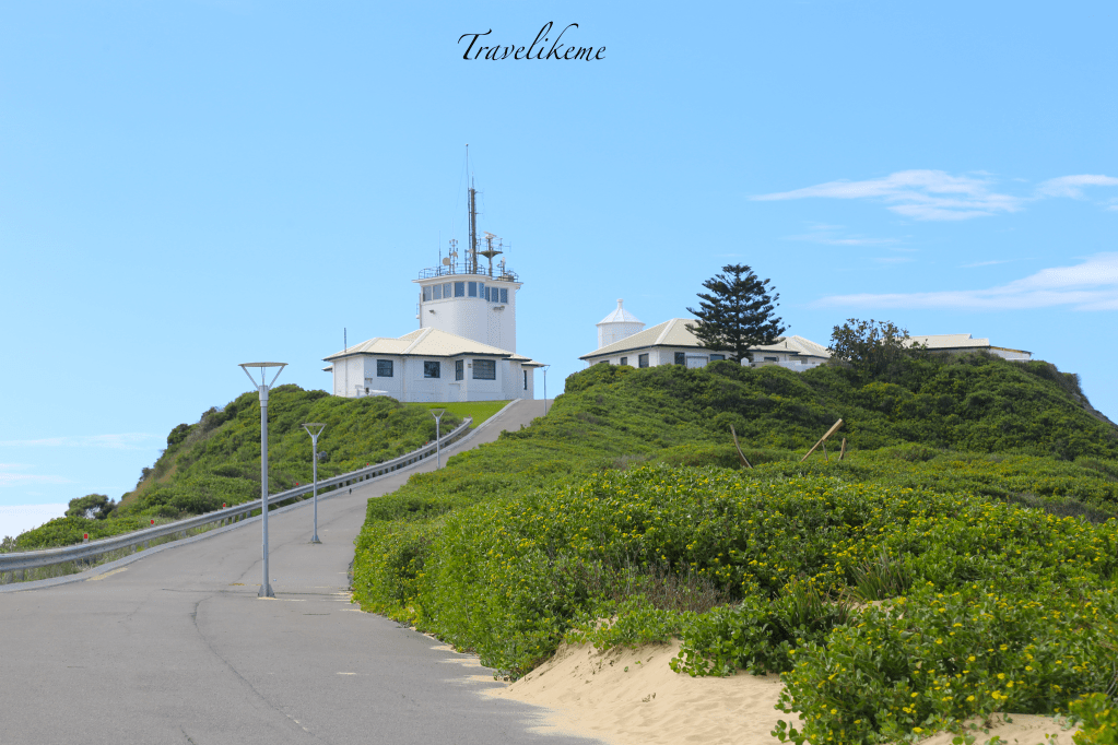
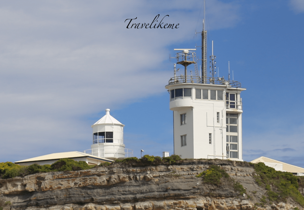
Presently there are 3 one-storey keeper’s houses, a 3-storey signal station & other buildings besides Nobby’s Headlight supporting the port watch.
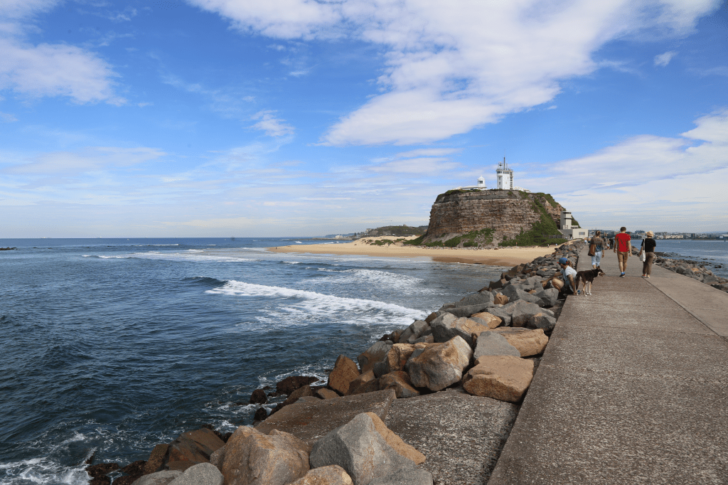
Macquarie Pier also known as Nobby’s Breakwall was designed to provide a safer passageway for coal ships coming into Newcastle harbour that would often get caught on the perilous oyster banks of Stockton. Though it may not rate amongst Australia’s most famous infrastructure projects, it was nevertheless pivotal in supporting Australia’s fledgling 19th century economy.
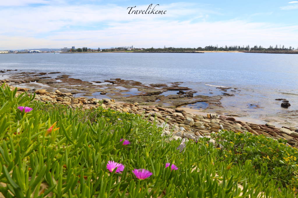
Looking out at Tasman Sea which is a marginal sea in the South Pacific Ocean situated between Australia & New Zealand. It is about 2,000km across & 2,800km from north to south.
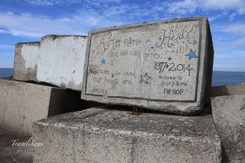
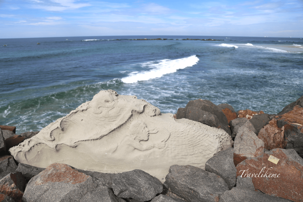
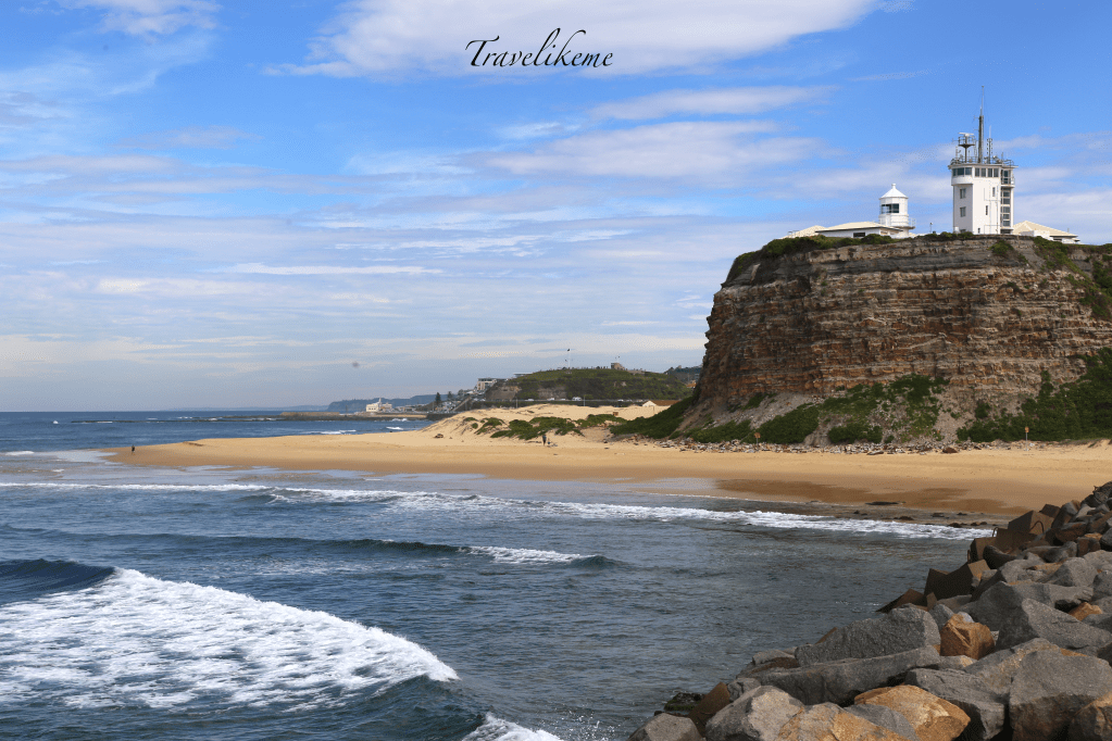
Nobby’s Head was originally 60m high & a stand alone little islet. Then in 1858 it was shorten to 25m to improve sailing conditions & also accommodate the Lighthouse & signal station. Looking from the end of Macquarie Pier or Nobby’s Breakwall which is an ever popular spot for joggers & visitors to Newcastle.
Nobby’s Lighthouse is significant as the first example of a series of Maritime lights installed in conformity to the Trinity House Codes after the Commission of 1856 & also the development of navigational aids along the coast of New South Wales reflecting the economic growth of the surrounding region.
Nobby’s Head is also known as Whibayganba, the traditional name as was found documented on the archived Aboriginal maps, sketches & fitting geological descriptions.
The lighthouse which is operated by Newcastle Port Corporation is open to the public on Sundays from 10am to 4pm. The first beacon in this area was an open coal fire set on Signal head. In 1821 it was changed to a large metal device burning oil with 12km visibility.
Nobby’s Headlight which was designed by NSW Government architect Alexander Dawson was built in 1858. It was eventually electrified & automated in 1934 using a 120v quartz halogen lamp with a diesel generator as a backup power source.
Nobby’s Headlight may stand at a diminutive height of 9.8m but this iconic conical landmark of Newcastle bears historical importance & together with her associated buildings are listed on the Commonwealth Heritage List.